An addressing site plan is a drawing of what is proposed on a lot. It is used by the City of Bellevue to assign street addresses to new construction projects. It must be a unique and separate document from any other site plan required for environmental and construction purposes. Do not submit any other site plan as an addressing site plan.
Note: Aerial photographs are not acceptable as addressing site plans. Please do not provide line work on top of imagery.
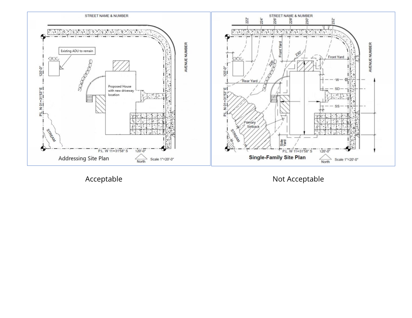
Requirements for an Addressing Site Plan
An addressing site plan must have a site address, north arrow and graphic scale, as well as the name, address and phone number of the preparer. You must verify and accurately depict all dimensions of property lines, streets, driveways and the primary entrance for all structures. Refer to Requirements for Electronic Plans for preparation information.
An addressing site plan should include:
- Property lines with dimensions.
- Streets or alleys abutting the property with the street name(s) identified.
- Driveways or parking garage entrances. If the project will include more than one driveway, the primary driveway should be highlighted.
- The location, size and use of proposed structures. If you would like to show current structures on the addressing site plan, please use a faint outline so the proposed structures are clearly visible. Any existing structures that will be removed should be clearly labeled.
- The primary entrance for each proposed structure.
- If your project includes street-level retail, include all external retail entrances and the primary egress for each retail space.
- If your project includes residential units, please provide either a floor plan showing each unit number, or provide a list of the residential units for the property.
- Row-house style projects should clearly depict each unit's primary entrance.
- If the property contains multiple parcels, please clearly label each with the assessor's parcel number.
- If the project includes multiple residential lots, please show the anticipated egress (driveway) from each lot.
Do not include any of the following:
- Contour lines
- Setbacks
- Easements
- Utilities
- Rockeries and retaining walls
- Depictions of critical areas
- Floor area ratio calculations
- Lot coverage calculations
- Impervious surface and hardscape calculations
- Plat conditions such as building setback lines
- Building height or area calculations
- FEMA floodplain elevation
- Other information that will obscure the proposed structure outlines, unit numbering or entrances.