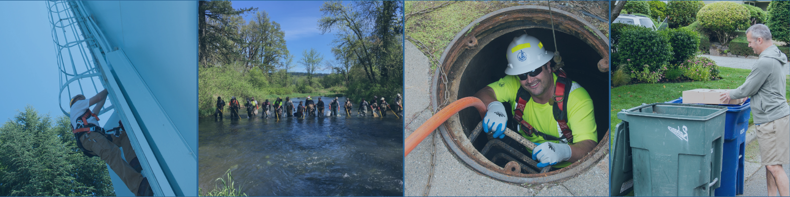
The City of Bellevue’s "Lake Lines" are part of the wastewater system located along Lake Washington and Lake Sammamish. About 15 miles of the lake lines run along the Lake Washington shoreline. These sewer pipes are either underwater or on land next to the lake. The lines connect to 15 pump stations and eight flush stations.
Most of the lake line system was built in the 1950s and '60s to prevent raw sewage from entering Lake Washington. The lines now serve more than 1,900 community members in Bellevue and neighboring communities. However, the lake line pipes are aging, and their location creates challenges for repair and replacement.
Why we developed a management plan
Without planning ahead, the lake lines will begin to fail. This could cause a loss of service to residents and be a risk to the sensitive lake environment. Bellevue Utilities developed a management plan for the future repair, replacement, and maintenance of the lines. The plan ensures we continue to provide safe and reliable sewer service to the community. The plan also protects public health and the delicate Lake Washington ecosystem.
Project location
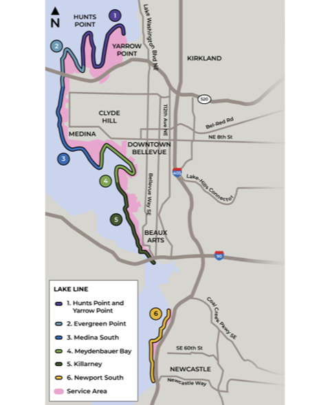
This project is located along and next to the Lake Washington shoreline in the following areas (identified on map):
- Hunts Point and Yarrow Point
- Evergreen Point
- Medina South
- Meydenbauer Bay
- Killarney
- Newport South
Plan development
The project team first collected and analyzed information about the lake line system. This information helped develop strategies for future repair, replacement, or maintenance. We then divided the lake line and its service areas into sections for individual analysis. While developing the management plan, the City completed an Environmental Impact Statement (EIS).
The City included feedback from community members and local partners in the management plan. Community members shared input through:
- Public surveys
- Online open houses
- A virtual public meeting
- In-person community events
Plan outcomes
View Final Lake Line Management Plan
The Plan prefers a combined approach to best meet the needs of each service area. The team analyzed four alternatives: no change, in-water, on-shore, and upland. Of the four alternatives studied, the Plan preferred a combination of on-shore and upland approaches.
The preferred alternatives may not represent a final solution for each service area. Before beginning construction, the City will collect more data to confirm project design. The City will also assess the financial and policy implications of each preferred alternative. The current information will allow Bellevue Utilities to start planning for these upcoming projects while gathering more information.
The preferred alternatives, by service area:
- Meydenbauer Bay: Upland
- Newport South: Upland
- Hunts Point and Yarrow Point: On-shore
- Killarney: Upland
- Evergreen Point: On-shore
- Medina Point: Upland
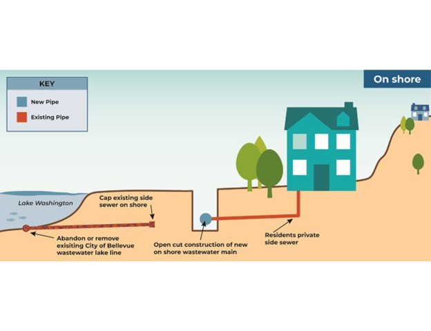
On-shore
For pipes near homes or the shoreline, potential solutions could include monitoring the lines for repair or replacing them. Methods could include placing new gravity sewer lines through open-cut construction or a vacuum sewer.
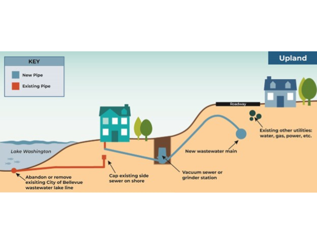
Upland
For pipes upland of homes, but within the public right-of-way, potential solutions could include monitoring, repairing, or replacing the lines. Methods could include placing a new gravity sewer line through open-cut construction. Methods could also include placing a new grinder pump or vacuum sewer.
Environmental Impact Statement (EIS)
For more details on how the Plan selected preferred alternatives, view the draft and final EIS:
What’s next?
With the EIS and Management Plan complete, Bellevue Utilities will assess the financial and policy implications of the preferred alternatives. Construction for each service area will happen in stages based on priority. Meydenbauer Bay is the first prioritized service area.
The project team is committed to ongoing engagement. We will continue to inform the public before design or construction begins on any service area.
Immediate next steps include:
- 2024: Assess financial and policy implications, continue data collection, and develop an emergency plan.
- As early as 2025: Implement the management plan (currently unfunded), starting with Meydenbauer Bay.
Stay informed
Please use the alerts section above to subscribe for project updates. The project team will share updates about the next phase of the project through this website, mailed notices, emails, texts, and more.
Contact us
Bellevue Utilities is committed to providing up-to-date project information. As the project moves into the next phase, we will keep you informed. For specific questions, please contact our team:
- For information and questions about the Management Plan: Please email LkWaLakeLine@bellevuewa.gov