Technology for safety and traffic management projects address the city’s capability to implement and respond to technology that improves safety, traffic flow, and traveler information, and other emerging technology, such as connected and autonomous vehicles. The technology is often referred to as Intelligent Transportation Systems, or ITS. Project descriptions, project costs and levy funding are subject to change. The following projects, along with all Levy-funded projects, can be found on an interactive map.
Projects completed
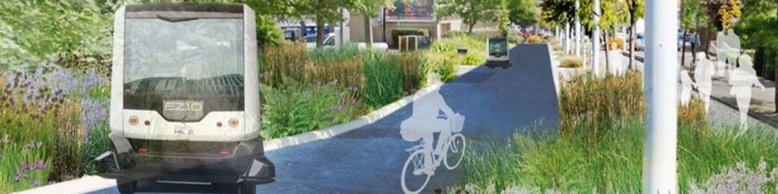
- The Autonomous Vehicle (AV) Strategic Vision is a planning document that is intended to help the City of Bellevue prepare for automated mobility. The plan evaluates the state of the AV industry, technology readiness, deployment risks, City of Bellevue’s role in enabling AV technology and identifies deployment scenarios.
- Bellevue/Overlake Connect First-Last Mile to Transit Project: The City of Bellevue, in partnership with King County Metro, Hopelink and Spare Labs launched an innovative transit service for the East Bellevue, called Crossroads Connect. Crossroads Connect provides on-demand rides for the service area with the goal of providing a reliable means of connecting with fixed route transit, such as the RapidRide B-Line. Crossroads Connect provides a free transfer to other King County Metro buses, through integration with the regional ORCA payment system. This pilot project started in fall 2020 and concluded in October 2021.
- Eastgate Park and Ride Mobility Hub Concept Design: The City of Bellevue and King County Metro partnered to develop a concept for the Eastgate Park and Ride that would better support integration with all travel modes to and from the park and ride and provide enhanced rider services to reduce additional stops or trips needed by the average commuter. This concept, called a mobility hub, looked at how the space on the park and ride property and along the west frontage could be modified to improve the safe and efficient movement of people by different modes of travel. Amenities envisioned for the park and ride included, but were not limited to, food trucks, common carrier lockers for package and carry-out food pickup, a café and public restrooms.
- ITS — Communications Upgrade: Upgrades to provide additional network capacity and redundancy for city’s Intelligent Transportation System. Also included planning, design and system integration to install citywide travel time system. Completed November 2018.
- ITS — Communication Upgrade Phase 2: As part of upgrading the city’s Intelligent Transportation System (ITS), continue the expansion of 10GB network to the remainder of the traffic signals in Bellevue. Completed December 2019.
- ITS — LED Street Light Upgrades: Replace existing high pressure sodium lights with light emitting diode (LED) light fixtures at Richards Road, from Lake Hills Connector to SE 32nd Street; Bel-Red Road/NE 12th Street, from Bellevue Way to 130th Avenue NE. Completed February 2018.
Projects in progress
-
Transportation for America Curb Space Management Partnership: Bellevue was selected, along with the Cities of Boston and Minneapolis, to serve as pilot cities for the study of new technology to manage curb space in an urban environment. This partnership builds upon similar work being done with the UW Urban Freight Lab and the federal Department of Energy. This project will deploy additional devices to monitor activity at the curb and will pay for consultant services to perform a comprehensive evaluation of all products tested for curb space monitoring. This project will help Bellevue and its partner agencies understand the functionality of the existing curb space monitoring technology and the potential uses for improving the management of this limited resource in an urban environment.
-
UW PacTrans Grant Partnership: The Cities of Bellevue, Seattle and Boise, along with Ada County Idaho have partnered with the University of Washington and University of Idaho to study ways to improve mobility in dense urban environments by increasing our understanding of existing curb usage and providing new solutions for managing this scarce resource. This study will develop innovative curb space designs to maximize the efficiency, safety and reliability of urban street systems.
-
UW Urban Freight Lab Department of Energy Grant Partnership: The Cities of Bellevue and Seattle partnered with the UW Urban Freight Lab and the Pacific Northwest National Laboratory on a Department of Energy Funded project to study the behavior of delivery vehicle drivers and develop a mobile application that predicts the availability of a load zone near their destination. The goal of the project is to reduce circling and illegal parking of delivery vehicles. The City of Bellevue has installed sensors near 10 load zones to provide real-time information regarding occupancy of the load zone.
Projects in planning/design
- Communication System Infrastructure Upgrades: This project builds and expands the city’s fiber optic network to improve system reliability and provide more high speed connectivity to facilities across the city. Fiber optic connectivity improves operations of the traffic signal system and enables traffic data collection systems, traffic camera systems, and smart city projects.
- Curbspace Management: This project deploys new traffic data collection systems and provide data analysis techniques to better understand existing curb activities and behaviors. Data from this project will help advance the city’s Curb Management Plan, which will serve as a guiding document for curbside planning in Bellevue.
- Mobile CCTV Camera System: This project will purchase and deploy a portable Closed Circuit Television (CCTV) camera that will provide city staff with a mobile resource for viewing roadway and traffic conditions where an existing camera does not exist. The camera can be redeployed to any location in the city where needed.
- Traffic Operations Performance Monitoring Phase 2: Phase 1 of this program is procuring a software program that can provide intersection level performance data out of the signal system that synchronizes traffic lights in Bellevue for optimal traffic flow. Phase 2 will integrate intersection data into a dashboard for monitoring that will include arterial performance information.
- Travel Time System: This project will deploy a travel time system along key arterial corridors in Bellevue. Travel time data provides city staff with a performance indicator which support transportation operations and planning needs.
- Winter Weather Response Map: This is a public-facing tool that will provide information on roads that have been cleared or treated during a snow and ice event. The map build upon the city’s investment in Automatic Vehicle Locator technology equipped on the city’s winter weather response vehicles.