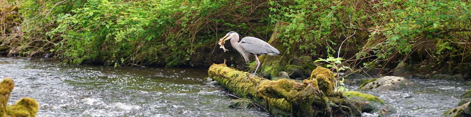

Bellevue staff conducted a city-wide Stream Habitat Assessment from 2018-2020 to help characterize our streams and provide a solid foundation for our Watershed Management Planning efforts.
Bellevue has more than 80 miles of streams – roughly the distance from Bellevue to Cle Elum - so the city-wide project required a big investment of time and resources. This project also relied on partnerships with streamside property owners who gave staff permission to cross private property for data collection purposes. Because Bellevue's streams run through the heart of the City and are home to salmon, fish, and other wildlife, establishing a solid baseline of existing habitat conditions was necessary. This data provides a better understanding of the current condition of our streams and will help inform how the City will move forward to protect and invest in the health of our streams into the future.
Stream Habitat Assessment Reports
- Vasa Creek Fish Habitat Assessment
- West Tributary Habitat Assessment
- Coal Creek Watershed Assessment Report including Appendix B (Open Streams Condition Assessment Subbasin Summaries for Coal Creek Watershed)
- Kelsey Creek Watershed Assessment Report
- Small Lake Washington Tributaries Watershed Assessment Report (April 2022)
- Lake Sammamish Watershed Assessment Report (March 2022)
- Data and reports will be added for the remainder of Bellevue streams as they are finalized.
Frequently asked questions
Who conducted the stream assessments?
An experienced team of two to three Bellevue staff walked the entire length of each stream from its mouth to its headwaters gathering physical and biological data.
What type of data was collected?
Data used to help characterize the stream was collected, such as habitat type, length, width, depth, substrate type, and presence of large woody debris and fish. The purpose of these surveys was to assess the health of our stream basins as a whole, they were not focused on individual properties.
When and where did stream assessments take place?
Stream habitat surveys were conducted across approximately 80-miles of Bellevue’s open stream channels from June of 2018 to October of 2020. Surveys took place when stream conditions and flow allowed. Larger creeks such as Coal, Lewis and Kelsey were surveyed during summer/early fall, when stream flows were safe for wading. Tributaries and smaller creeks like Yarrow, Sears, and Valley may be surveyed year-round, if they have streamflow. Previous surveys occurred in Vasa Creek (2014) and West Tributary (2016).
Why were stream assessments being done?
The Open Streams Condition Assessment was one of Bellevue’s five strategic initiatives, identified in the City's 2015 Storm and Surface Water Plan with the goal of informing future management decisions in a holistic citywide approach to managing storm and surface water.