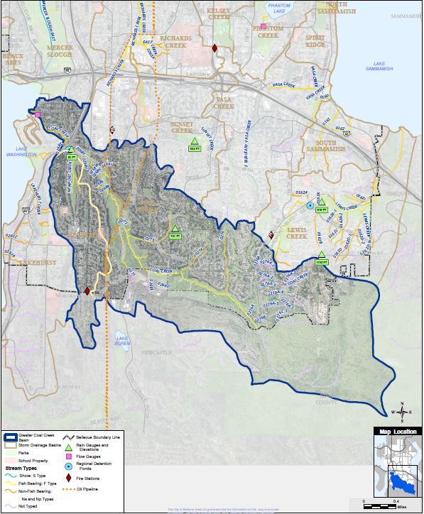
Lake Washington Watershed (WRIA 8)
Updated: July 2017
The City of Bellevue does not guarantee that the information on this map is accurate or complete. This data is provided on an "as is" basis and disclaims all warranties.
Please check out the PDF fact sheet version
Land Characteristics
Basin Area
4,551 Total Acres
City Area
13.2%
Drainage Jurisdiction(s)
Bellevue: 62.6%
Beaux Arts: 0.0%
Clyde Hill: 0.0%
Issaquah: 0.0%
King County: 23.4%
Kirkland: 0.0%
Medina: 0.0%
Newcastle: 13.9%
Redmond: 0.0%
Renton: 0.0%
Lowest Elevation
18 Ft
Highest Elevation
1,563 Ft
Total Length of Open Channel
20.0 Miles
Total Length of Storm Drainage Pipes:
65.7 Miles
Salmon Present in the Basin
- Chinook*+
- Coho+ (juveniles)
- Sockeye
- Rainbow & Cutthroat Trout
- Steelhead
- Coho+
* Listed Federal Endangered Species
+ City Species of Local Importance (Bellevue Land Use Code 20.25H.150A)
Population
The population density in Bellevue ranges from 1,344 to 9,851 people per square mile.
Basin Population (2016)
17,699
% of all Basins
11.7%
Basin Population Density
2,489 People per Square Mile
Land Use
| Entire Basin | Within Bellevue | |
|---|---|---|
| Public Right of Way | 11.1% | 15.6% |
| Commercial/Office | 7.1% | 0.5% |
| Industrial | 1.2% | 0.0% |
| Institutional/Government | 2.0% | 2.5% |
| Mixed Use/Misc | 4.1% | 5.3% |
| Multi-Family | 0.4% | 0.2% |
| Open Space/Park | 36.8% | 20.3% |
| Single Family Residential | 34.5% | 51.2% |
| Unknown | 3.0% | 4.4% |
Land Cover
| Entire Basin | Within Bellevue | |
|---|---|---|
| Impervious | 23.0% | 32.0% |
| Tree Canopy | 55.0% | 44.8% |
| Impervious in 100 Ft Stream Buffer | 8.2% | 9.9% |
| Tree Canopy in 100 Ft Stream Buffer | 86.2% | 83.2% |
