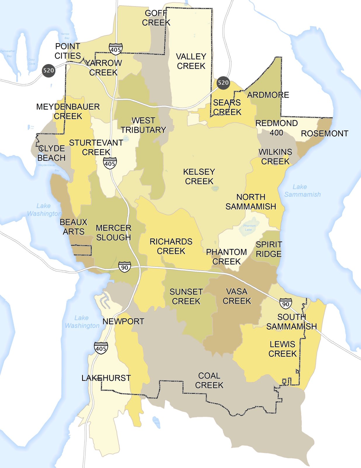
Bellevue has 25 drainage basins – areas of land that each drain to a stream or lake. City staff have prepared fact sheets that offer a snapshot of the built and natural conditions in each drainage basin.
Drainage basins are small watersheds, and have natural boundaries defined by the shape of the land and the flow of the water; smaller watersheds become part of larger watersheds. Each basin in Bellevue eventually drains to either Lake Sammamish or Lake Washington. Bellevue lies within the larger Lake Washington/Cedar/Sammamish watershed that drains to Puget Sound.
Choose a basin from the dropdown list under the map for detailed stream and land use information for that basin area. This page also has links to citywide maps, data and reports about the surface waters in Bellevue.
Citywide Maps: Streams, Water and Land Use
-
Isopluvials - areas of similar rainfall measurements:
- LIDAR (Light Detection and Ranging) - topographic view of Bellevue
- Salmon and Trout Distribution and Culverts Showing Fish Passage
- Rain Gauges, Flow Stations & Regional Stormwater Detention Facilities
- Stream Water Quality Assessment - Department of Ecology Map
Citywide Data and Reports: Streams, Water and Land Use
- Wet Season Rainfall Analysis
- Rainfall - Largest Storms - from the 1980s to the present
- Rainfall - Large Storm Frequency - 1995 to the present
- Rainfall - Storm Frequency Curves - for the Seattle metropolitan area
- Rainfall – Bellevue Precipitation, 1981 to the present
- Fish Use of Bellevue Streams
- Summer Fish Monitoring Reports
- Streams Biological Assessment Reports
- Stream Benthic Index of Biotic Integrity Summary - 1998-2011
- Stream Typing Report - Appendix A, Appendix B, How to Use Stream Types
NOTES: Some stream types have changed. The Bellevue Land Use Code defines Type F waters to include all stream segments that “contain fish or fish habitat.” The code further defines fish habitat as “any habitat which is used by any fish at any life stage at any time of the year, including potential habitat likely to be used by fish that could be recovered by restoration or management". - State Stream Numbers
- Definitions and Data Sources
- Didn't find what you're looking for? Utility Data Request Form
External Links
- Washington Department of Ecology River and Stream Monitoring
- GeoMapNW - Geologic Mapping Studies - interactive local maps of the Puget Sound area
- Regional Salmon Conservation - Greater Cedar/Sammamish Watershed (WRIA 8)