Header Image

The maps provided on this page are the official FEMA maps from the federal Department of Homeland Security. The maps are based on the FEMA Flood Insurance Studies (FIS) listed below and are used to assess whether a property is located within a floodplain. They do not show insurance rates but do show various FEMA flood zones insurers use to calculate rates. Once you know where your property is in relation to the floodplain, please contact an insurance agent to learn more about insurance rates.
To find the FEMA map for your property:
- Use the map index to determine which map panel contains your property.
- Click on the panel or the panel number to the right of the map Index.
- The Special Flood Hazard Areas within the floodplain that require mandatory insurance are A and AE zones shaded in gray. These are the areas likely to flood, with a 1% chance of occurrence in any given year.
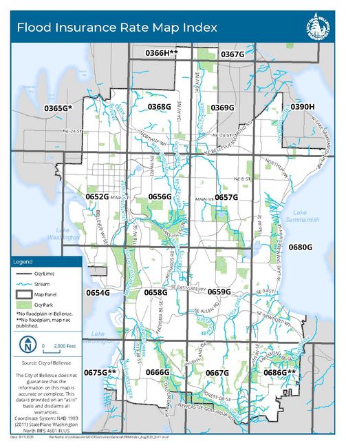
**Areas covered by panels 0366H, 0675G, and 0686G have no floodplains - no map is available. |
0366H** 0675G** 0686G** |
FEMA Flood Insurance Studies
These studies below are used to make FEMA maps.