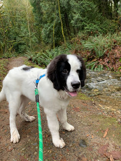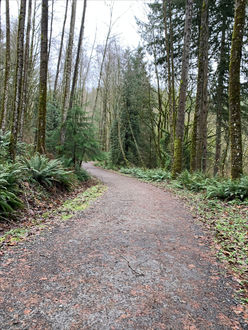
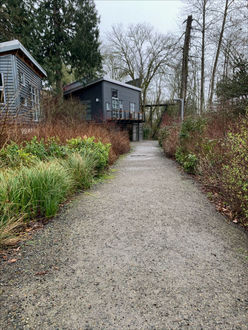
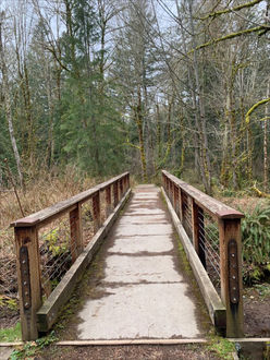
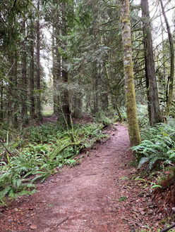
TRACKS hikes range from 1.5 to 3 miles, reach elevations up to 500 feet, are easy-moderate and will take you on different surfaces like gravel, packed dirt and mulch. These are some of our favorite hikes from our Tuesday Trails program and explore some King County trails, regional and state parks that are in and around the Bellevue area. Please note that trails in this series are not maintained by the Bellevue Parks Department. Exercise caution as wet weather can make trails, bridges and boardwalks slippery.
For more information about our Tuesday Trails program, watch Tuesday Trails video or view the Tuesday Trails flyer.
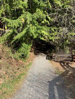
Bridle Trails State Park
Bridle Trails State Park
5300 116th Avenue NE, Kirkland, WA 98033
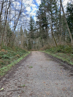
Difficulty: Moderate- packed gravel trail
Distance: 1 to 3.5 miles
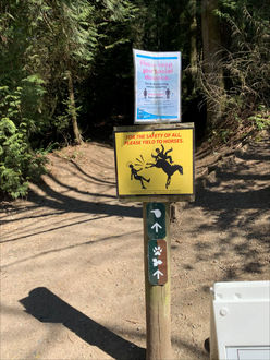
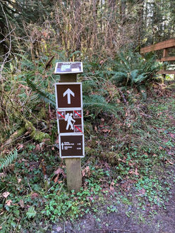
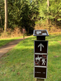
This week we are heading just north of Bellevue to Bridle Trails State Park. Note this park does require a Discover Pass to park in the parking lot. Once you enter the parking lot, you’ll notice parallel parking for cars and horse trailer parking in the middle of the lot. The trailhead is in the north end of the lot. Make sure to take a look at all the signs and note that hikers yield the trail to horses.
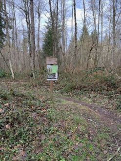
Stop by the trail kiosk and take a look at the trail options.
- The Raven Trail is one mile and is marked with a raven icon.
- The Trillium Trail is 1.6 miles and is marked by a flower icon.
- The Coyote Trail is marked with a paw print icon and is the longest loop at 3.5 miles.
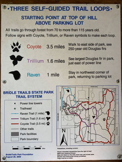
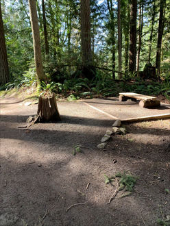
You really can’t go wrong in picking a trail here, since the trails are wide and well maintained as they weave through this park. The Raven Trail is a lovely short walk in the northwest section of the park. This trail will take you in a nice loop and end near the riding and horse rings.
Coal Creek Natural Area
Coal Creek Natural Area
- Parking: Trailhead parking is on Coal Creek Parkway between Forest Drive and SE 60th Street
- Trail surface: Mud, gravel, stairs, bridges
- Distance: 1.5-3 Miles
- Difficulty: Moderate
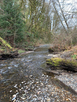
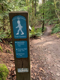
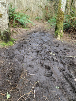
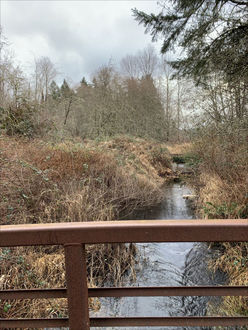
This week we are checking out Coal Creek Natural Area. This forested area will make you feel like you are out in the wilderness without leaving Bellevue. The trail follows along the creek that provides valuable fish and wildlife habitats. This trail connects all the way to the Red Town Trailhead at Cougar Mountain Regional Wildlife Area. This trail can be great for both short and long hikes. Start at the trailhead off Coal Creek Parkway and make your way back into the trees. The first part of the trail follows the creek closely, so make sure to take your time checking out the wildlife around the water.
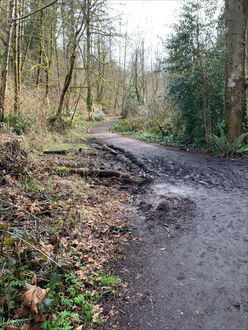
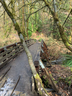
Follow the trail as it ascends a set of stairs. Cross a bridge after about a half a mile. The trail veers to the left, and there is a short uphill section. When you see a trail sign, head for the Primrose Loop.
If you are feeling tired by the cut-off for the Primrose Loop, feel free to head back the way you came, and the hike will be 1.5 miles. Continue on the Primrose Loop, and the hike will be 3 miles. The Primrose Loop offers sweeping views of the creek from up on the ridge as well as access down to the water.
When the Primrose Loop trail comes back to the main trail, follow the signs back to Coal Creek Parkway. At this point the trail diverges from the creek and heads up into the trees. Enjoy the change of scenery, and you will once again be back at the sign for the turn for the loop. Retrace your steps back across the bridge and along the creek on your way back to the parking lot.
Coyote Creek - Klondike Swamp Trail Loop
Coyote Creek - Klondike Swamp Trail Loop
Distance: 2 miles
Parking: Sky Country Trail Head located at the end of 166th Way SE
Difficulty: Easy, paved and packed dirt/mud
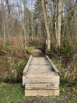
This week's hike starts again at Sky Country Trail Head, but heads out in a different direction to explore more of the trails in Cougar Mountain Regional Wildlife Park. For this week's hike you will start on Clay Pit Road. Access from the parking lot to Clay Pit Road is around over a bridge/boardwalk on the west side of the parking lot, near the exit.
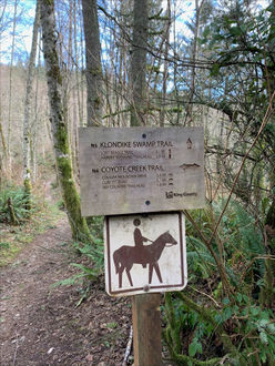
After you cross the small bridge, take a right and head up the paved road. This road is closed to traffic, but watch out of the occasional trail work crew truck. Continue to follow this road for a little over a quarter mile. Look for a trail sign off on the left-hand side for Coyote Creek Trail.
Once you are on Coyote Creek Trail, continue through the trees. This trail can get muddy after heavy rains, so watch your footing as you go. The trail stays fairly flat, and there are no major uphill paths as you wonder through the wetlands.
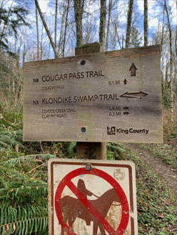
After about three quarters of a mile, you will come to a fork in the trail. Turn right toward the Klondike Swamp Trail. There is a slight downhill here as you transition to the other side to the wetlands.
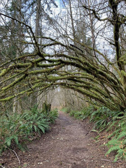
The Klondike Swamp trail takes you back along the other side of the wetlands, Keep your eyes out for a moss-covered tree canopy. Note there are a few other trails that intersect with the Klondike Swamp trail as you go, but keep straight.
After just over a half mile you will once again connect with Clay Pit Road. Take a right on the road and follow back toward the parking lot, you will once again pass the turn off for Coyote Creek Trail as you retrace your steps to finish this hike.
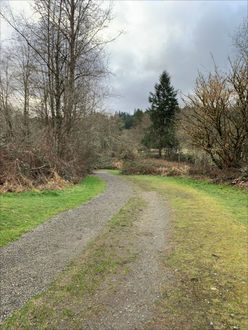
Evans Creek Preserve
Evans Creek Preserve
4001 224th Ave NE
Sammamish, WA
Difficulty: Easy
Trail surface: Packed dirt, boardwalks and crushed gravel
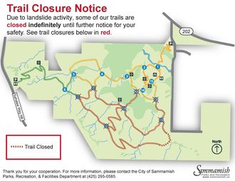
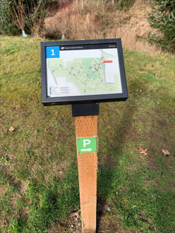
This week we head out to Evans Creek Preserve in Sammamish. It’s just a short drive from Bellevue, and the tranquil trails are worth it. Note that some of the trails in this area are closed, so please mind the signs and areas marked as closed. This area is well marked with numerical trail markers which make navigation easy. Check out the map below.
From the parking area, check out the kiosk. Note the warning about slippery boardwalks, and make sure to watch your step. The trail starts with a switch-back that leads to an open road with a bridge at the end.
Just after the bridge, you will see the first trail marker.
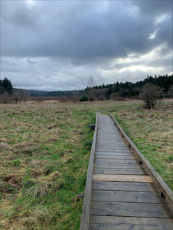
Continue on past the bathrooms, and take a left at Trail Marker 15. Head over the boardwalk and admire the meadow view.
Next you’ll come to an intersection with Trail Marker 12. Note that the trail is closed to the south, so take a right and head toward Trail Marker 14.
Continue on to Trail Marker 3 and the planked viewpoint. This hike offers lovely meadow views throughout. After you’ve taken in the scenery, keep going toward Trail Marker 4 and then 5.
Continue straight toward Trail Marker 8, and you will once again notice signs for the closed section of trail. Head back toward Trail Marker 4, then 3, and make your way back to 2. At this point you will recognize the open picnic area and can stop for a rest or continue on back to the parking area.
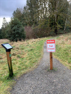
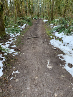
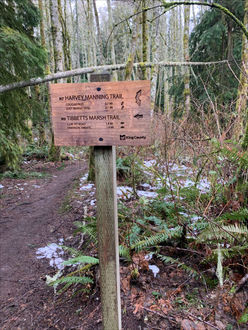
Harvey Manning to Tibbetts Marsh Trail
Harvey Manning Trail to Tibbetts Marsh Trail
Parking lot: Harvey Manning trailhead parking lot is located at the end of SE Cougar Mountain Drive.
Trail condition: Moderate - mud and uneven trail, narrow bridges.
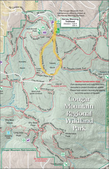
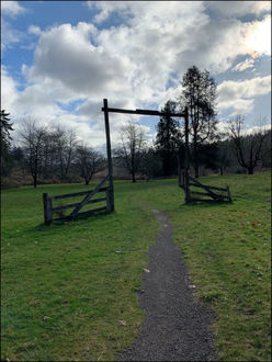
This week we are starting our hike near the top of Cougar Mountain at the Harvey Manning trailhead. To get to this trailhead, follow SE Cougar Mountain Drive all the way up until it ends in the parking lot. There are many trails accessible from this trailhead, and this week we are going to explore the area around Tibbetts Marsh. From the parking area, head down past the kiosk to the first trail sign, and follow it right toward Tibbetts Marsh Trail.

As you wind through the trees, you’ll slightly descend. After about a quarter of a mile you’ll reach the intersection of the Tibbetts Marsh Trail and the Harvey Manning Trail. Follow the Tibbetts Marsh Trail, and you’ll finish your loop coming back on the Harvey Manning Trail.
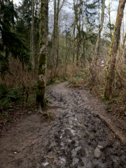
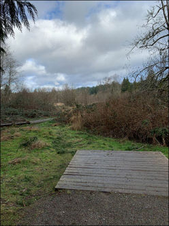
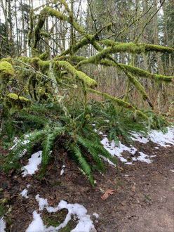
Due to the wet winter weather, watch your step as the trail is quite muddy in places. Next you will see the intersection with the Protector Trail; again, stay to the right and continue on toward Cougar Pass. You’ll cross over Tibbetts Creek on a narrow bridge, so watch your step. Your loop will continue on Cougar Pass Trail for a short while before linking up with Harvey Manning Trail. As you head back up to complete your loop, notice how the moss keeps the forest looking lush even in the dead of winter.
Mercer Slough Nature Park
Mercer Slough Nature Park
1625 118th Ave SE
- Distance: 2 miles
- Trail Surface: Moderate- mulch, mud
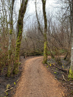
This week our hike is back in the heart of Bellevue. If you haven’t checked out Mercer Slough Nature Park yet, this is the perfect opportunity! This park is conveniently located near downtown Bellevue, but the dense forest and wetlands will make you feel much further away. Park at the Mercer Slough Environmental Education Center. From there, head past the trail map and down the trail on the back side of the building.
This trail will lead you along the edge of the park on the Bellefields Loop. This part of the trail has a few short but steep hills. After this bit of elevation, the rest of the hike is flat. The winter weather has left areas of deep mud, so make sure to wear shoes or boots you can get dirty.
The trail comes to a set of stairs; at the bottom, veer right.
The trail then heads into the wetlands. The trail surface is a mix of mulch and boardwalks, much less mud to worry about. After about a quarter mile you will see the first glimpse of the slough channel. Take a minute to watch the water, birds, beavers, frogs and turtles, all at home in the slough.
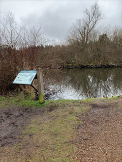
Once you have spotted some wildlife, continue on your way. You’ll come to a directional sign and should head on the boardwalk toward the Slough Channel Bridge. The bridge will allow you to see down the middle of the channel and get a better view of wildlife.
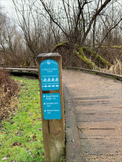
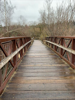
You can feel free to continue across the bridge and straight down the boardwalk toward Bellevue Way. The trail to the right of the bridge takes you past the blueberry fields toward Winters House, but it’s very muddy this time of year. Come back later in the year to better explore it. When you’ve gone as far as you like, turn back across the bridge. You will come to a trail sign pointing back toward 118th Avenue SE. Head to the right to complete the Bellefields Loop.
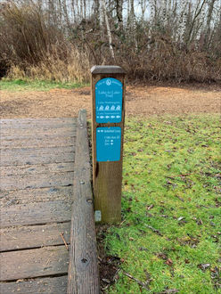
Redmond Watershed Preserve
Redmond Watershed Preserve
21760 Novelty Road
Redmond, WA 98053
- Distance: 2 miles
- Trail condition: Gravel and packed dirt
- Difficulty: Moderate
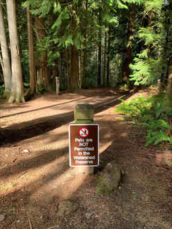
This week we are heading to neighboring Redmond to hike through the Redmond Watershed Preserve. While many hikes are dog friendly, please note that no pets are allowed on the trails here. The hike begins at the kiosk in the parking lot. Here you can pick up a trail map and use the restrooms.
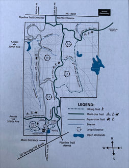
PDF of Redmond Watershed Preserve Map
Start off down the trail and head toward the Connector Trail. After a short walk through the trees you will come to a four-way trail intersection. Take a right down the Power Line Trail. Walk under the Power Line for a few hundred feet until you see a fence, and bear left as the trail heads back into the trees.
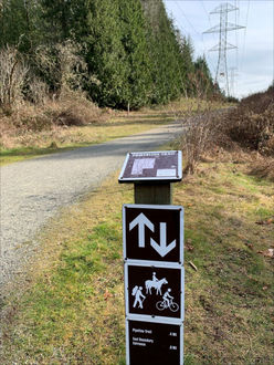
As you wander through these Douglas fir and western hemlock trees, take a minute and notice how many birds live in this forest. This trail will cross a short bridge and then intersect with the Pipeline Trail. Continue on the Pipeline Trail to the right. This trail runs the full length of the preserve, so if you are looking to extend your walk, feel free to continue along it.
The next trail intersection you will come to is the start of the Siler Mill Trail. If you chose to take this additional loop, your hike will be about 3.5 miles. It is a lovely and quiet walk through the woods. If you are looking to keep your hike to around 2 miles, continue on to the next intersection.
At the next intersection, take a left on the Connector Trail and head toward the Trillium Trail. As you again wind through the trees, you can start to notice the first signs of spring in the foliage.
Next you’ll arrive at your last intersection. There is a lovely bench and place for a water break. Once you are done, continue on to the left, back toward the South Parking Lot. This trail will take you all the way back to the first four-way intersection you passed at the beginning of your hike. Continue on straight back to the parking area.
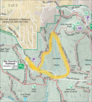
Sky Country to Coal Creek Falls
Sky Country to Coal Creek Falls
Parking: Parking for the Sky Country Trailhead is at the end of 166th Way SE, about a half mile from the intersection with SE Cougar Mountain Way.
Distance: 3 miles.
Difficulty: Moderate.
Trail surface: Crushed gravel, packed dirt, mud.
This week's hike takes you back to Cougar Mountain but starts at the Sky Country Trailhead. This trailhead offers a paved parking lot with more spots than the Red Town Trailhead, so it is a good alternative if the parking at Red Town is full.
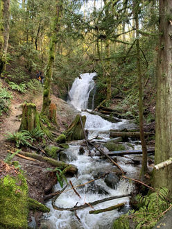
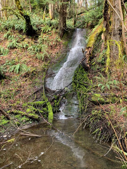
This week's hike will take you to Coal Creek Falls. Winter is a wonderful time to view the falls because the water level is higher during the winter due to the rain runoff. Try this hike again in the summer, and the falls may only be a trickle.
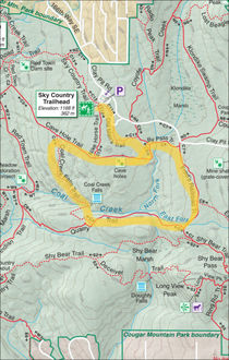
Start your hike at the Sky Country Trail kiosk. Head down the trail and follow trail signs; you'll see remnants of the airfield that used to be here.
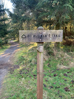
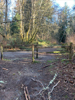
Follow the 'Old Man Trail' until you see a split fence. Take a right at the split fence and continue on the Cave Hole Trail. The Cave Hole Trail is a wider open trail that heads downhill for a little over half a mile.
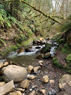
As you reach the bottom of the trail, you will come to a fork with a sign leading you towards Coal Creek Falls. The trail narrows and winds through the forest for about another half mile. As you walk, you will begin to hear the creek below you. The falls will come into view ahead. Take a minute to admire them on the bridge over the creek.
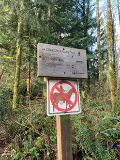
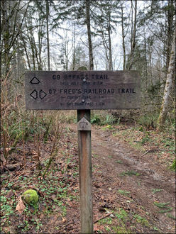
If you are looking for a bit of a shorter hike, you can turn around at the falls and head back the way you came. If you'd like the full three miles, keep going across the bridge and back up away from the creek. As you wind your way up the hillside, the incline will become a little steeper. At the intersection with the Quarry Trail, take a left toward Fred's Railroad Trail.
This part of the trail is a bit of a climb until you reach the next intersection with Fred's Railroad Trail. Take a left again and head towards Clay Pot Road.
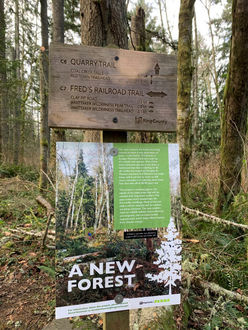
Once you are on Fred's Railroad Trail, the incline is behind you. Enjoy this walk through the forest as you head back toward the trailhead. After a half mile you will see a Bypass Trail that will take you back to the Cave Hole Trail. Take a left on the Bypass. Once you hit the Cave Hole Trail, take a right. This will take you back towards the split fence and the Old Man Trail you started on and back to the parking lot.
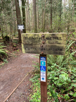
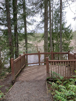
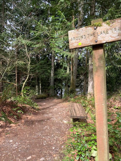
Tradition Lake
Tradition Lake
- Parking: Highpoint Trailhead, 26415 SE 79th Street, Issaquah
- Distance: 1.5 miles
- Difficulty: Easy
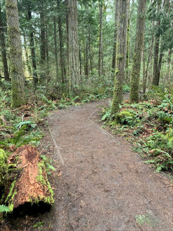
We are headed a little bit outside of Bellevue to explore the area around Tiger Mountain. The Highpoint Trailhead is a great starting point for many trails around Tiger Mountain. For a nice 1.5 mile hike, follow the Tradition Lake - Around the Lake Loop.
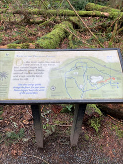
After you pass the trail sign and map, continue down the trail and make sure to check out the scenery. Keep an eye out for signs explaining the wildlife in the area. Continue over a small stream.
After about a quarter of a mile you’ll come to the first overview of the lake, so take a minute to check out the birds and ducks that call the lake home. When you’re ready to continue on, you’ll come to an intersection in the trail. Follow the Around the Lake sign.
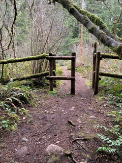
The trail veers away from the lake slightly and into the trees. Watch your step as the trail becomes a little more uneven with rocks and roots. After another quarter mile you will come to a fence. Head through the fence and take a right on the gravel path.
The path leads back along the far side of the lake and back to the parking area.
Wilburton Hill Park to Kelsey Creek Farm
Wilburton Hill Park to Kelsey Creek Farm
• 2 miles
• Easy/Moderate: Mix of gravel trail and sidewalk, downhill and uphill.
• Parking for this hike can be found at Wilburton Hill Park, 12400 Main Street.
This week we are exploring the connection between Wilburton Park and Kelsey Creek Farm. There is a large parking lot, and the trails start at the south end of the lot near the play structure. The gravel trail will wind around the play structure and then head down the hill beyond the outfield of the ball field.
This section of the trail consists of wide and gentle downhill switchbacks as you wind through the trees. After about half a mile the trail comes to 128th Ave SE.
Take a right and head down the sidewalk toward SE 4th Place. Take a left on SE 4th Place which leads directly into the Kelsey Creek Farm parking lot. After crossing the bridge, continue past the picnic shelter, and you'll see the big white barn (here's the white barn welcome sign).
In the barnyard you might be able to see goats, sheep, cows and horses enjoying the pasture in front of the barn along the road. Once you say hi to all the farm life, loop back through the park and head back up SE 4th Place to 128th Avenue SE and walk back the way you came
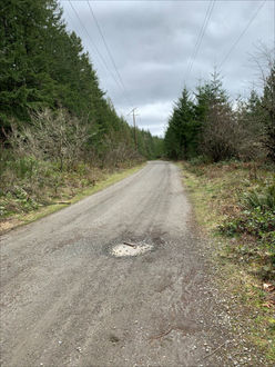
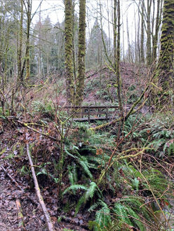
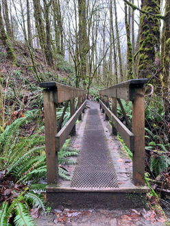
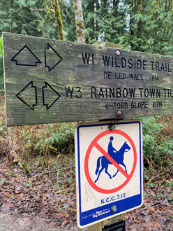
Wildside to Red Town
Wildside to Red Town Trail
Distance: 1.5 miles
Parking: Red Town Trail Head (Lakemont Boulevard SE- just south of Forest Drive SE)
The Cougar Mountain Trail system offers miles and miles of interconnected trails. Make sure to grab a map at the trail head or download one ahead of time from the King County Parks website.
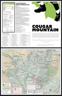
View Cougar Mountain Regional Wildland PDF
This hike will explore the Wildside to Red Town Trail loop. This look takes you through the Meadow Restoration Project and though some lovely forest.
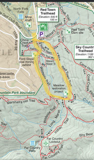
Start this route on the trail that leads past the picnic tables toward the Wildside Trail. After a few hundred feet you will see a bridge to the right - turn right and cross the bridge.
Next you will come to an intersection with the Rainbow Trail and the Ford Slope Mining exhibit Stop and take a look at the area’s mining history and then head off toward the Wildside Trail.
Follow this trail along the creek and through some twists and turns. You'll see turn-offs for Marshall's Hill Trail as well as another Wildside Connector. Stay straight and you'll come into the Meadow Restoration Project.
After making it through the meadow, stay on the wide gravel trail and follow signs for the Red Town Trail and Red Town Trailhead. Note this is a great trail for dogs, but please make sure to follow all leash and scoop laws.